|
|
Fern Climbing Area:
Fern is a predominately a sport climbing area, with some trad, and a lot of bouldering. It has roughly 30 or so developed routes. The bluffs will average about 40' or so, and have chain anchors at the top of most of the routes. If you have a 4x4 or any type of off road vehicle you can drive right down to bluff making for an easy approach.
|
| |
Directions to the Fern Climbing Area:
FROM FORT SMITH:
Take I-40 east. Take the Mulberry exit for Hwy 215. Go north on 215 for approximately 10 miles. Once you enter the town of Fern you will pass a small church then an A-Frame house on the right. You will take the next dirt county road on the right, after the house. Follow the county road for 1.2 miles to a turn off with a large mud puddle right at the entrance. From here (off road vehicle advised) follow the dirt road down the hill, take the first sharp left. Then take the first right, you will park just after the first right. You can see logs lining the path down to the bluff. Just be sure to leave room for the next climber to park.
FROM RUSSELLVILLE:
Go west on I-40 to the Mulberry exit for Hwy 215. Then follow directions from Fort Smith.
|
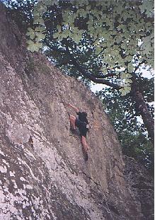 Rich on a Fern 5.9 There are plenty of 5.9-5.10 sport routes at Fern to keep the weekend warrior coming back.
|
| |
Camping at the Fern Climbing Area:
Camping at Fern is acceptable. It is 100% primitive, so plan on being self-sufficient. There is plenty of room to pitch a tent near the parking area.
|
 Nearby Camping Areas
|
| |
Fern info?:
Do you have any Fern info, like route names or new beta on any new routes going up? Let me know by emailing me at: Gator211@msn.com
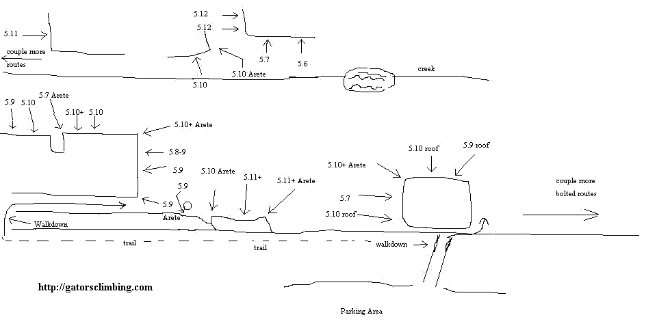
Here is a map to give you a general idea of how to get around Fern. This should suffice until a guidebook becomes available.
Fern map:
Click to enlarge.
|

|
|